
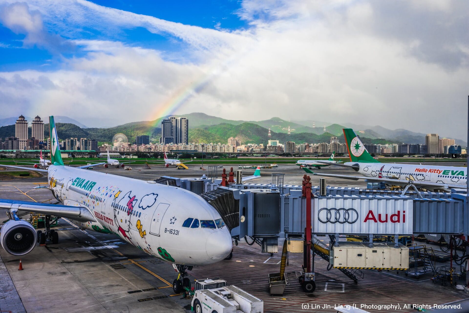
Here is a piece of travel trivia for everyone: does anyone know which airport is the northernmost on the main island of Taiwan? Is it Taipei Songshan Airport, or Taoyuan International Airport (formerly Chiang Kai-shek International Airport)?
This question is a bit of a geographical trick. In many people’s perception, Taipei is geographically further north than Taoyuan, so naturally, Songshan Airport must be further north than Taoyuan International Airport. However, Taipei and Taoyuan actually overlap across the same latitude lines. Furthermore, Taoyuan International Airport was originally planned and built in northern Taoyuan to serve as a vital gateway for the Republic of China (ROC) and maintain close connectivity with the capital. Conversely, the available location in Taipei City with adequate conditions to build Songshan Airport was situated closer to the center. As a result, the actual north-south difference between the two airports is far from obvious.
Looking at geographic coordinates, Taoyuan International Airport is located at 25°04′35″N 121°13′26″E, while Taipei Songshan Airport is located at 25°04′11″N 121°33′09″E. Judging purely from north latitude, Taoyuan International Airport sits at a slightly higher latitude, though this refers strictly to a single reference coordinate point.
Looking at the distribution of northern airports on the island below, although Taoyuan International Airport is marked slightly further north than Taipei Songshan Airport, observing the entire airport zones reveals that Taoyuan International Airport extends further south geographically than Songshan Airport.
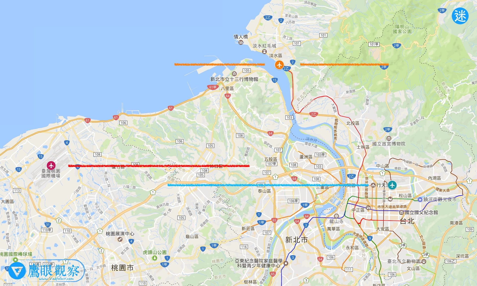
Furthermore, did you notice another runway line in the Tamsui area in the image above?
Back in 1937 during the Japanese colonial era, near No. 7, Lane 42, Zhongzheng East Road—right by the exit on the right of today’s Taipei Metro Tamsui Station, adjacent to the Tamsui Weather Station and the British Douglas Lapraik & Co. / Shell Warehouse area (25.164415°N, 121.447473°E)—the Japanese authorities began building Taiwan’s second international airport [1], the “Tamsui Seaplane Base”, following the Marco Polo Bridge Incident and the outbreak of the Second Sino-Japanese War, for military operations and bolstering commercial aviation routes to Southeast Asia.
Times have changed. After Japan surrendered and the seaplane base was taken over by the Republic of China (ROC), it was never reopened for operational flight use. Today, the site has become a designated historic monument of New Taipei City overgrown with vegetation. But if the Tamsui Seaplane Base is counted, it is unequivocally the northernmost airport on the main island of Taiwan.
Speaking of which, if you wonder what the northernmost airport in all Republic of China (ROC) territory is: since the Diaoyu Islands have no airport, beyond the well-known Beigan Airport and Nangan Airport in Matsu, Dongyin Airport (coordinates: 26°21′41″N 120°28′30″E) in Dongyin Township, Lienchiang County, is even further north. However, it only operates scheduled helicopter flights to and from Nangan Airport.
As for the southernmost airport, most people are likely familiar with it, as Dr. Ma Ying-jeou, then President of the Republic of China (ROC), visited it several times aboard military transport aircraft. That is none other than Taiping Island in the Spratly Islands!
Further Reading & References:
[1] Taipei Songshan Airport Official Website; the first international airport on the main island of Taiwan.
[2] Taoyuan International Airport (formerly C.K.S. International Airport) Official Website.
Support Independent Perspectives & In-Depth Insights
Every thoughtful analysis and candid critique comes from our dedication to truth and quality. We choose not to follow sensational algorithms or clickbait headlines.
Sustaining independent research requires reader support. Make a one-time or monthly contribution, securely processed by Google.
Payments secured by Google · Manage or cancel anytime in your Google Account

Comments